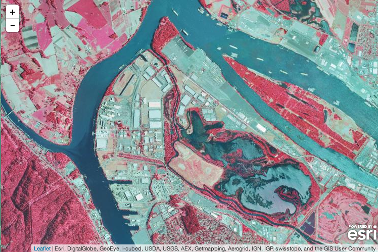
I’m excited to see support for ArcGIS image services landing in Esri Leaflet Beta 6. In addition to serving up raster data such as imagery and digital elevation models, image services provide powerful analytical capabilities. Now Leafelt users can visualize infrared imagery and LiDAR data, get the elevation where a user clicks, and much more. I’m looking forward to seeing how the Leaflet community brings these new capabilities into their applications.

Displaying Imagery
Esri Leaflet now includes the L.esri.ImageMapLayer class to display an ArcGIS image service as a layer on a map. This layer supports all of the common image service visualization parameters, so users can set the visible bands, rendering rules, and/or mosaic rules used to display the imagery.
Identifying Imagery
Esri Leaflet also now includes the L.esri.Tasks.IdentifyImage class to get information about an ArcGIS image service at a given location. The results of the identify request will include the pixel value (or values for multi-band imagery) at the location and optionally the metadata and/or footprint of the raster(s) that overlap that location. The identify task also supports mosaic and rendering rule parameters if you want those applied before the pixel value is calculated.
Finally, the L.esri.Tasks.Query class now supports querying image services to get metadata about the rasters in the catalog.
Getting Involved
If you use Leaflet and ArcGIS image services, I hope you give the new capabilities a spin and provide some feedback. Patrick Arlt and other Esri Leaflet contributors not only do a great job responding to issues, but have made it easy to contribute thanks to a very solid code base and automation of developer tasks like linting, testing, and building the library and documentation site. This made it easy for me to jump in and make contributions that are well tested and documented, and I encourage you to do the same.