Loader of the Things: One Library to Load Them All

UPDATE 5/11/18: The recently released @arcgis/webpack-plugin is a viable alternative to esri-loader if you are using webpack with the latest version of the ArcGIS API for JavaScript. See this blog post for details on when you should use one or the other.

The esri-loader library hit the 2.0.0 milestone this week.  This release doesn’t add any features, but merely removes the old callback APIs that were deprecated when we introduced the promise-based ones in v1.5.0. If you’ve been using the new APIs, you can save yourself a few bytes by upgrading to 2.0.0. You can read more in the 2.0.0 release notes.

One does not simply load modules from the ArcGIS API
One does not simply load modules from the ArcGIS API

The work leading up to this milestone got me reflecting on the broader state of loading ArcGIS API for JavaScript modules and I came to this conclusion:

If your ArcGIS web application uses any other module loader besides the Dojo loader (i.e. webpack, Rollup.js, etc.), you should be using esri-loader.

That’s a bold statement, so let me back it up.

Continue reading “Loader of the Things: One Library to Load Them All”
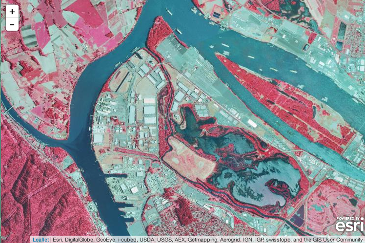
ArcGIS Image Service Support in Esri Leaflet

I’m excited to see support for ArcGIS image services landing in Esri Leaflet Beta 6. In addition to serving up raster data such as imagery and digital elevation models, image services provide powerful analytical capabilities. Now Leafelt users can visualize infrared imagery and LiDAR data, get the elevation where a user clicks, and much more. I’m looking forward to seeing how the Leaflet community brings these new capabilities into their applications.

Infrared Imagery in Esri Leaflet
Using the new L.esri.ImageMapLayer class to display an ArcGIS image service in Esri Leaflet

Continue reading “ArcGIS Image Service Support in Esri Leaflet”

Generating Custom Widgets for Esri’s WebApp Builder with Yeoman

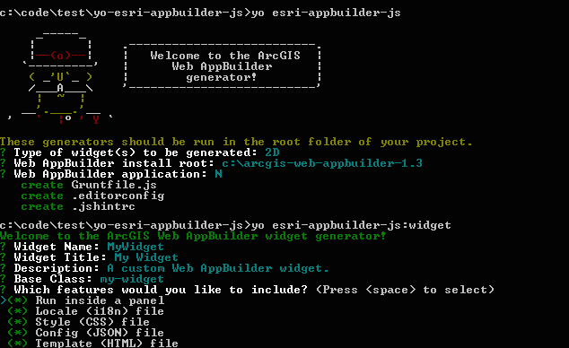
Recently I’ve been developing custom widgets for the ArcGIS Web AppBuilder, and I have found that there is a lot of boilerplate code that you have to create for each new widget. I thought that a Yeoman generator would be a useful way to scaffold out the widget files, so I created generator-esri-appbuilder-js.

What It Does

The package contains a couple of generators that walk users through a series of prompts to gather information about a custom widget that they want to develop for the Web AppBuilder, and then scaffolds out the widget’s files.

Screenshot of running the generator-esri-appbuilder-js generators
The generator prompts you for widget properties and then scaffolds out the required files.

Continue reading “Generating Custom Widgets for Esri’s WebApp Builder with Yeoman”

Using Bootstrap Map? You Might Not Need jQuery…

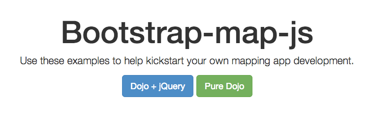
I’ve been working with Allan Laframboise to add examples of how to use Esri’s popular Bootstrap Map framework without a dependency on jQuery. The Dojo-Bootstrap library, a Dojo port of the Twitter Bootstrap JavaScript modules, finally has a release candidate that is compatible with Bootstrap 3.x. This enabled us to replace the references to the Bootstrap JavaScript with references to the Dojo-Bootstrap modules and completely remove the reference to jQuery.

Bootstrap Map: Now with Dojo-Bootstrap
Now you can choose whether you’d like to get started using Bootstrap with jQuery or Dojo.

You can try out the new Dojo examples live at:

http://esri.github.io/bootstrap-map-js/demo/dojo/getstarted.html

Continue reading “Using Bootstrap Map? You Might Not Need jQuery…”

Resources from our Esri DevSummit Presentation on JavaScript Testing

At the recent 2014 Esri Developers Summit in Palm Springs, Dave Bouwman, David Spriggs, and I presented on Testing Tools & Patterns for JavaScript Mapping Apps.

The video, slides (PDF), and links to related resources from that talk are all now available at the GitHub repository we created for the talk.

Personally, I think Dave Bouwman’s introductory section on the how and why of JavaScript unit testing is as good as any presentation or book (mapping or no) that I’ve seen or read on the subject and is definitely worth a watch.

Beyond that, if you’re interested in the mechanics of testing mapping apps with any of the frameworks we cover (the Intern, Jasmine, Karma, etc) there are plenty of resources to get you going.

Esri Landscape Modeler Application

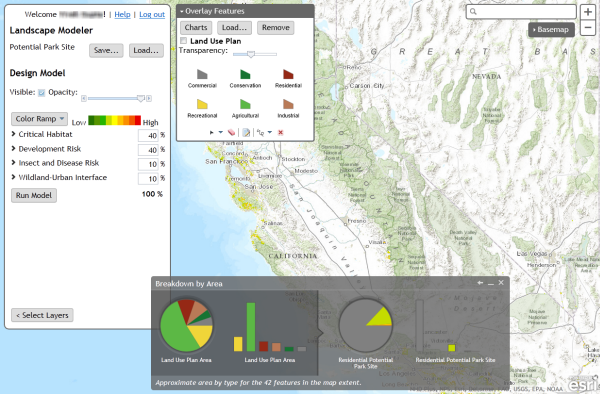
Screenshot of Landscape Modeler

This week the Landscape Modeler application that was previewed at the International User Conference in June has hit the ArcGIS Marketplace.

Landscape Modeler is a web application that allows users to perform fast weighted overlay analysis at multiple scales or over a large area. This is ideal when there are multiple users that want to develop their ideas about suitability analysis models and share their results with each other.

You can find out more about Landscape Modeler listing on ArcGIS Marketplace (don’t worry, it’s free to any user with an ArcGIS Online organizational account). However, I wanted to mention a few things that I find interesting about this application from a developer’s perspective.

Continue reading “Esri Landscape Modeler Application”

Landscape Modeler Application Presented at Esri UC 2013

The Landscape Modeler application that I’ve been working on was presented during the plenary session of the 2013 Esri International User Conference. Lanscape Modeler is a JavaScript application that enables ArcGIS Online users perform weighted overlay analysis with the new landscape datasets that Esri is hosting on ArcGIS Online. The application is able to perform real-time weighted overlay at scales ranging from that of a city to the entire country by leveraging the ability of ArcGIS image services to apply raster functions on the fly.

Below is a video of the quick 2 minute run through that Suzanne Foss presented in San Diego where she demonstrates how to use the application to develop a conservation plan for an area outside of Santa Cruz:

The app will be released in the coming weeks, so stay tuned.

Community Maps Contribution Management Application Released

For the better part of my first year at Esri, I have been working on a web application for the Community Maps Program that would make it easier for program contributors to upload and manage their data contributions. We released a minimally viable version of the web application in the fall of 2012 which focused on letting users register for the program and upload data. Since then we have focused on creating an application that lets users manage the complete lifecycle of their contributions from upload, through data review, map cache generation, and finally incorporation into the Esri basemaps. This version came out of beta at the beginning of this month.

The application is for program participants only, but if you are interested in learning more about or contributing to the program you can learn more by visiting the ArcGIS Online features page for Community Maps.

Continue reading “Community Maps Contribution Management Application Released”